 – for all paddlers
🚀 New: canua is now available in English. The new version 3 also brings a new interface, an enhanced paddling map and much more. The most comprehensive update ever. All details on the new features are available directly on the home screen of the app, under canua Version 3.
🛶 canua is the app for everyone who travels the rivers, lakes and canals of Europe by canoe, kayak and SUP. Discover the paddling map of canua, based on the official canoe database of the DKV, to learn about the waters, track your trips and plan your paddles.
🐚 canua is free in the basic version and available on iOS and Android. Premium features are available with canua Edition PLUS.

 Download at
 Canua App – The best paddling app for kayaking and SUP in Europe
Canua: Your digital paddling companion
By paddlers for paddlersThe best source of information for paddling
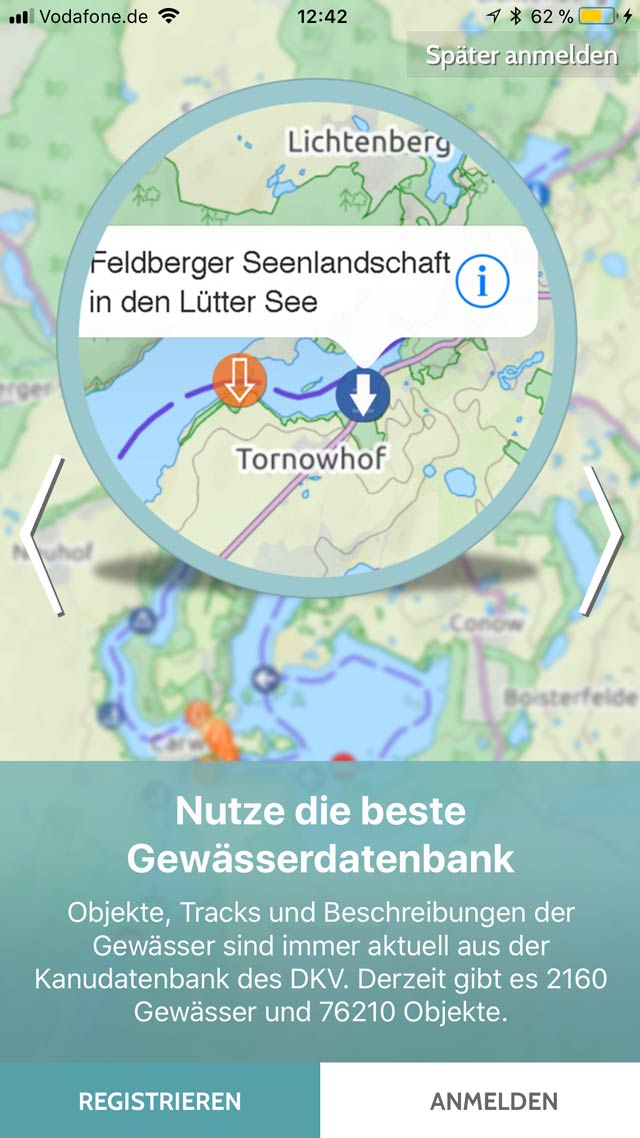
The precise water body information and canua's detailed maps contain everything you need to plan, record and navigate a paddle and inspire others.
Get acurate river descriptions and courses to the kilometre, easily find launching and landing points, weirs, locks, and other obstacles as well as campsites and touristic spots and much more. Paddling tours and paddling regions are always at hand and up-to-date with Canua.
The rivers and lakes of Europe are waiting for you.
Canua offers general information and local details on more than 5000 paddleable waters in over 20 countries in Europe, with new rivers, canals, lakes and waters being added all the time.
For example, in addition to the waters of Germany and neighboring countries, the rivers of the Czech Republic, Sweden, Great Britain, Spain, the Baltic countries and Corsica are included, as well as the 2850 km long course of the Danube from its source to its mouth in the Black Sea.
Canua in action: video insights
Canua experienceThis is canua
Uwe is planning a tour on the Lahn loop near Weilburg (in German language)
Canua features for perfect paddling trips
the best features of canua with and without registrationLeading Information System for Paddling
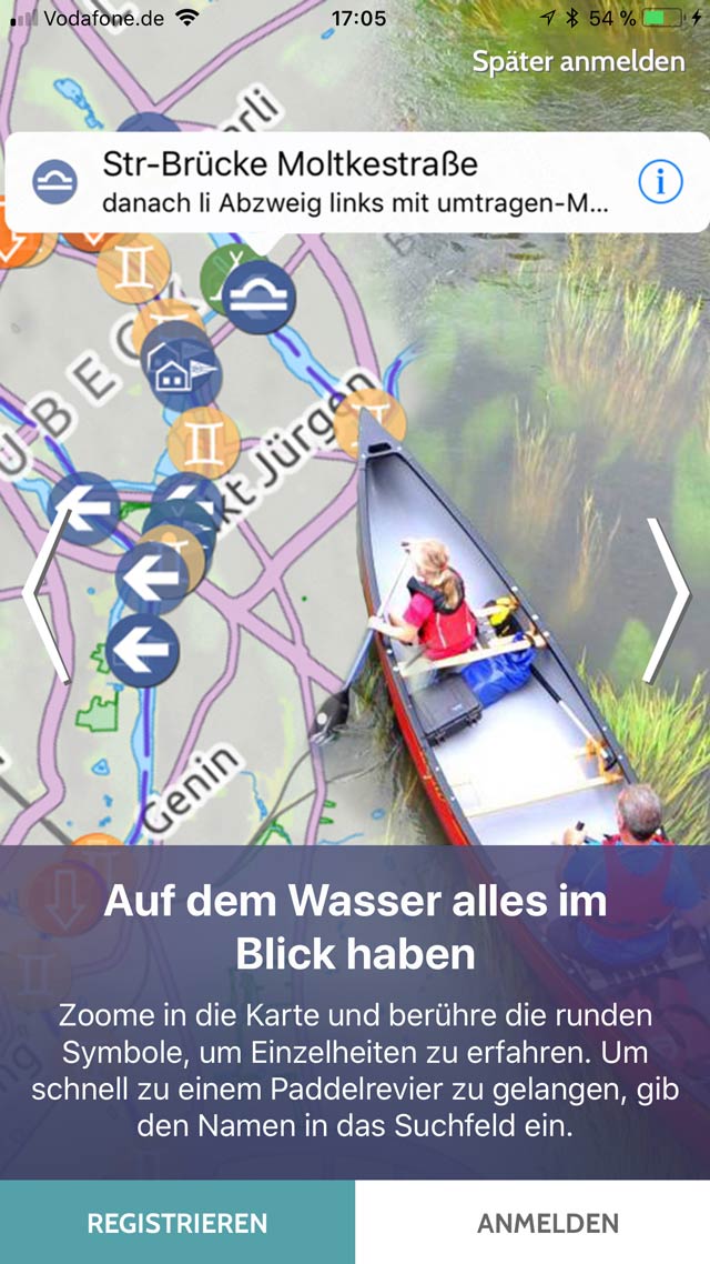
Find over 150,000 geopoints of water knowledge on the map. These are the entry points to tour planning, navigation and orientation.
Browse through more than 5000 waters and get the best most up-to-date information for your paddling.
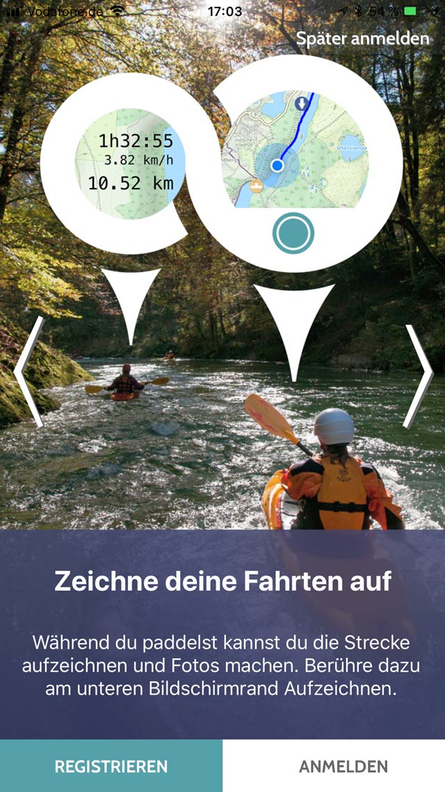
GPS tracking for paddling trips
Record your movements directly with the GPS of your smartphone and create tracks of you trips.
A few changes in the settings and your phone creates excellent tracks of your paddle and stand-up trips. You can transfer them to your electronic logbook (eFB) at the DKV.
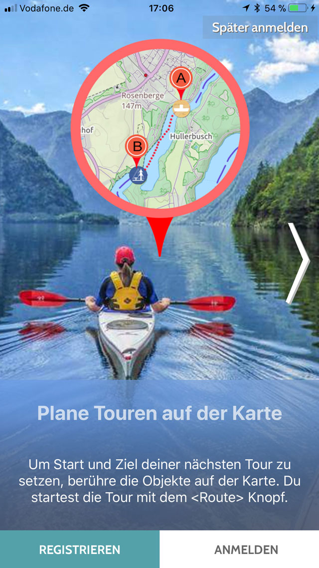
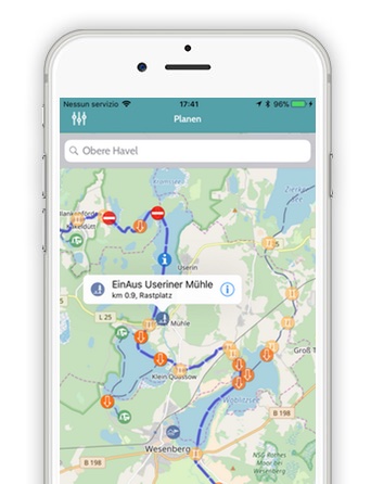
Plan your paddling
Set a route in the map and then paddle according to it.
Simply use the geopoints as start and finish of your paddling or set A and B freely on the water. Add stopovers to sharpen the route and see how many kilometers it is and how long it will take you.

Update water body information
Participate and keep the paddling information system even more up-to-date. Just enter your feedback directly at each geopoint and each water body.
All messages are processed by the DKV water editorial team and the changes appear in canua in no time.
Discover Europe's paddling waters
In the alphabetically ordered water catalog, you will immediately find all the waters you love and the ones you will love.
The water catalog knows all spellings and all names of the waters. Browse the list or search specifically and find great paddling destinations.
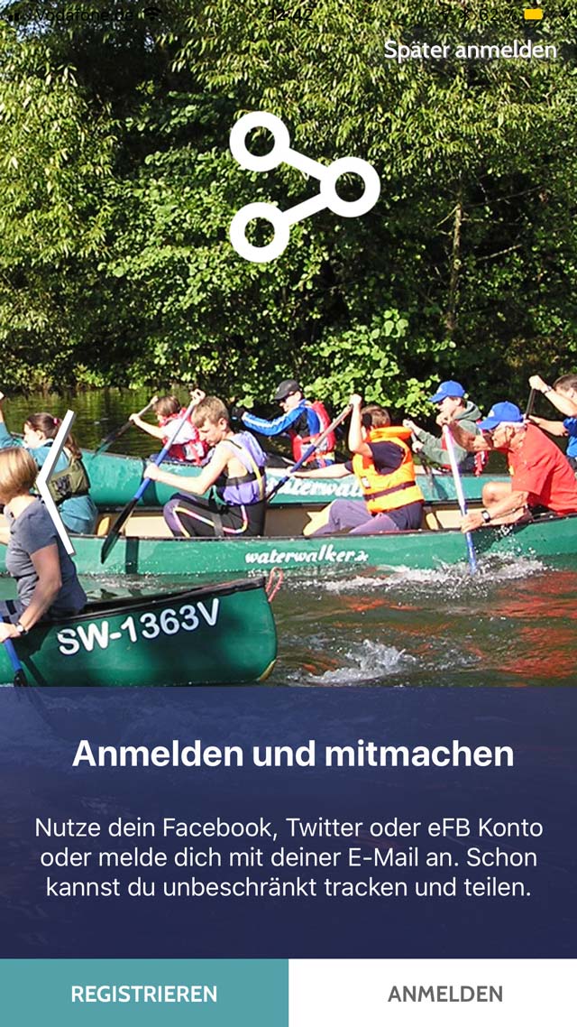
Share tours & community
Share your planned route and recorded tracks with others and invite them to join you on the water.
Canua automatically creates for you a description of the route with the most relevant geopoints and a map section.
~~~ℹ~~~
Not all features are available on all platforms, some features require the canua Edition PLUS. More information about the Edition PLUS including a feature overview is available here.
The information you get thanks to the Canua app in a perfect map for paddling is indispensable when you set out on a river in whatever vehicle.
tig@ct.dec't 14/2019 S.91
I use canua because it gives me access to over 150,000 paddling objects from the DKV water information system when planning trips.
Dieter ReinmuthHeiligenhaus, Managing Director, DKV Verlags-GmbH
I use canua because it allows me to track my paddling trips and upload them to the electronic logbook.
Albert EmmerichCremlingen, DKV
With Canua I record all my trips to be able to evaluate them. Especially the exam drives. The smartphone is in a waterproof sleve with which I can also make phone calls.
Gabriele KochBonn, Resort Manager Service at DKV


